Map Your Own Hiking and Biking Trails with Topo Maps US
Map your own hiking and biking trails using your device’s GPS.
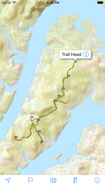
Add trails to your map from any GPS point by simply tapping the “Add Points” option on the “Trails” screen.
Record a trail and follow it later.
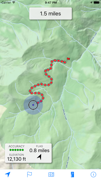
Find and record a trail, or add a trail to your map, by tapping the “Record” option on the “Trails” screen.
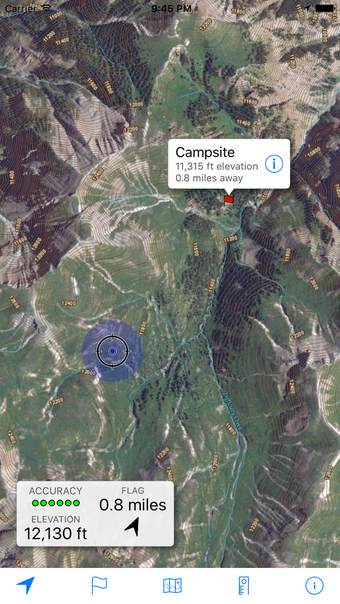
Navigate to a trail by tapping the arrow that appears when you tap a trail on the map.
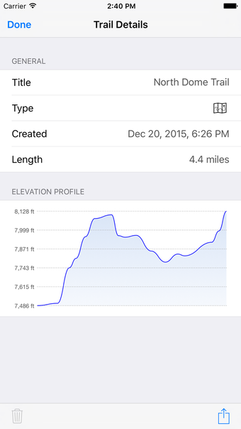
Get an elevation profile for a trail by tapping the “Add Elevation” option on the “Trails” screen.
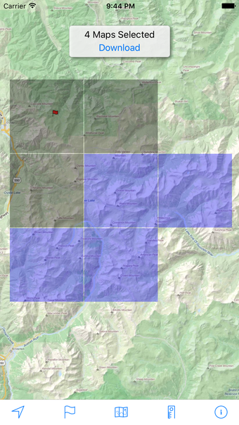
Download maps for areas of interest to view them later when you don’t have Internet access or you don’t want to use cell data.
View topographic maps covering the United States.
Choose from 2 map sources: USGS standard topographic or USGS hybrid topographic.